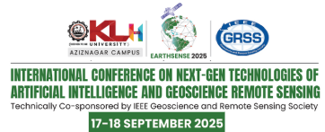
EarthSense 2025
“EarthSense 2025” (#66084) – IEEE INTERNATIONAL CONFERENCE ON NEXT-GEN TECHNOLOGIES OF ARTIFICIAL INTELLIGENCE AND GEOSCIENCE REMOTE SENSING is a global conference that brings together scientists, engineers, industry leaders, and policymakers to explore the latest innovations in artificial intelligence and geoscience remote sensing technologies. It is in collaboration with KL University and IEEE SB KLEF. It is technically sponsored by IEEE GRSS (GeoScience and Remote Sensing Society). The conference will focus on the next-generation tools, methodologies, and applications driving advancements in Earth observation, environmental monitoring, and resource management. The conference is a unique platform for showcasing cutting-edge research, fostering interdisciplinary collaborations, and discussing future directions in geospatial and remote sensing science. It aims to advance these fields and promote sustainable and ethical AI/ML practices in the geoscience domain by bringing together researchers, practitioners, and policymakers.
TARGET AUDIENCE –
-
Geoscientists, environmental scientists, and researchers.
-
Remote sensing engineers, data scientists, and AI/ML experts.
-
Industry leaders and innovators in geospatial technologies.
-
Policymakers, environmental organizations, and public health professionals.
-
Students and young professionals interested in Earth observation and geospatial technologies.
We extend a heartfelt welcome to each of you and look forward to your active participation in making EarthSense2025 a resounding success.
Selected papers will be published in a Special Issue on Integrating AI and Earth Observation Data for Disaster Risk Reduction by SPRINGER NATURE, IF- 2.2, SCOPUS, SCIE
KEYNOTE SPEAKERS
I am text block. Click edit button to change this text. Lorem ipsum dolor sit amet, consectetur adipiscing elit. Ut elit tellus, luctus nec ullamcorper mattis, pulvinar dapibus leo.
The conference will cover a wide range of topics, emphasizing the latest technologies and their applications across various domains. Below are the suggestive tracks with subtopics(but not limited to..)
Advanced Remote Sensing Technologies:
- Next-generation satellite platforms (e.g., smallsats, cubesats, hyperspectral sensors).
- Innovations in LiDAR, SAR (Synthetic Aperture Radar), and thermal imaging.
- UAVs (Unmanned Aerial Vehicles) and drone-based sensing for environmental monitoring.
- AI and machine learning for image processing and geospatial data analysis.
Sensors in Remote Sensing Technologies:
- AI-Driven Data Processing for Remote Sensing Sensors
- Integrating data from multiple sensors to improve accuracy and insights.
- Low-Cost and Miniaturized Sensors for small-scale, affordable remote sensing systems
- Applications of Thermal and Infrared Sensors in Environmental Monitoring
- Urban planning and land-use analysis through sensor data.
- Sensor fusion methodologies for multi-source data integration
Climate Change and Disease Monitoring:
- Impact of changing climates on the prevalence of infectious diseases
- Geospatial monitoring of emerging health risks due to extreme weather events
- AI models for predicting climate-sensitive diseases (e.g., cholera, heatstroke)
- Remote sensing of water sources to study waterborne diseases
- Identifying regions vulnerable to climate-induced health crises
Natural Hazard Detection and Disaster Management:
- Early warning systems for earthquakes, floods, and landslides using remote sensing.
- Satellite-based monitoring for disaster response and recovery.
- Real-time data for wildfire detection and mitigation.
- Role of geospatial data in post-disaster healthcare delivery and logistics.
Environmental Monitoring and Sustainability:
- Remote sensing of ecosystems: biodiversity, land use, and vegetation analysis.
- Water resource monitoring and hydrology using satellite data.
- Precision agriculture: Monitoring soil health, crop yield prediction, and pest control.
- Urban sustainability: Mapping urban heat islands, pollution, and resource management.
Data Fusion and Big Data Analytics:
- Integration of multi-sensor and multi-platform data for enhanced Earth observation.
- Big data platforms for geospatial data storage, analysis, and visualization.
- Cloud computing for real-time geospatial data processing.
- High-performance computing for large-scale geospatial simulations.
Sustainable Agriculture and Forestry Management :
- AI for crop monitoring and yield prediction using remote sensing
- Early detection of pests and diseases in vegetation with geospatial data
- Remote sensing for forest biomass and carbon stock estimation
- Geo-AI for precision farming and irrigation optimization
- Monitoring afforestation and reforestation projects with satellite imagery
- Climate change effects on vegetation patterns using remote sensing data
Geoscience in Energy and Renewable Resource Management:
- Remote sensing for exploration and sustainable extraction of natural resources.
- Monitoring renewable energy infrastructure (solar, wind, hydropower).
- Environmental impact assessments of mining, drilling, and deforestation activities.
- Energy efficiency monitoring in urban and industrial areas.
About KL University:
The Koneru Lakshmaiah Charities was established as a trust in 1980, with its official address at Museum Road, Governerpet, Vijayawada, and it started KL College of Engineering in the academic year 1980-81. KLEF was established in 1980-81 as KL College of Engineering, which was upgraded to KL College of Engineering Autonomous in 2006 by UGC and was declared a Deemed to be University in 2009 by UGC, MHRD Govt. of India. In 2012 as a Deemed to be University the institution was accredited by NAAC with A Grade and later in 2018, was re-accredited by NAAC with A++ grade. In 2019 UGC, MHRD declared this intuition as Category I. The university was also ranked 22 under NIRF 2024. KLU Hyderabad campus was started as an offline branch in 2017 at Aziz Nagar, Near TSPA Junction, Hyderabad. KLUH Aziz Nagar campus offers three undergraduate technical programs, B.Tech- ECE, CSE and AI & DS and two undergraduate programs BBA and BCA.


Comments
Post a Comment